As we close in on Monday’s potential tornado outbreak, we are also honing in on what areas may be at greatest risk. And almost unbelievably for this early in the spring, the most concerning area is from Southern Minnesota into Iowa and Western Wisconsin.
The Southern Plains are usually the center of tornado activity this time of year, and this setup is quite astounding. A low pressure riding through Northern Minnesota will cause the low level jet to bring Gulf moisture and instability all the way into the Upper Midwest.
Whereas with a classic Southern Plains setup, we would be looking at a low coming out of Colorado and pushing into Nebraska. The Southern Plains is still under a threat of severe weather Monday, but the much greater threat will be up north as you get closer to the low pressure center.
Potential for a Tornado Outbreak on Monday
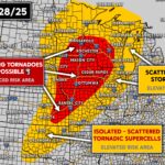
Below is a look at the Storm Prediction Center’s threat map for Monday. While “Moderate” may not sound too bad, it’s actually rarely issued. A Moderate Risk is defined as “High confidence that many storms will contain damaging winds, severe hail, and/or tornadoes.”
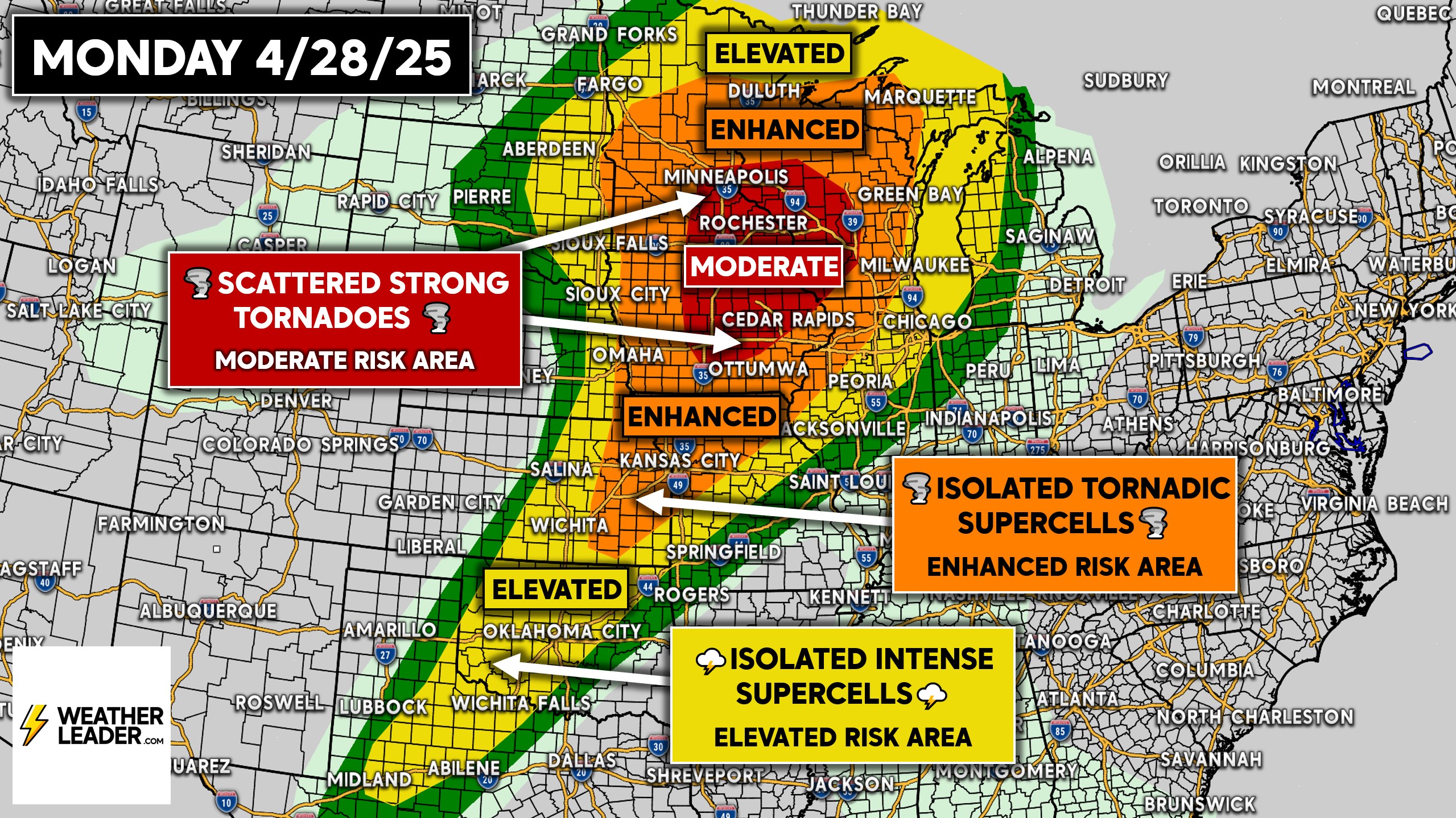
The highest concern for tornadoes will be with the first thunderstorms to develop in Southern Minnesota and Iowa. These will be discrete supercells pushing east, ahead of a line of storms that will likely form to the west on the leading edge of the cold front.
This means places like Des Moines, Iowa and Rochester, MN need to be on high alert late Monday afternoon and evening. But make no mistake, all of the Enhanced and Elevated Risk area down to OK and TX should be monitoring radar and alerts.
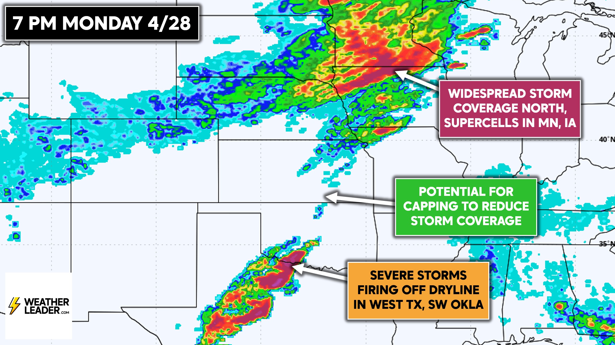
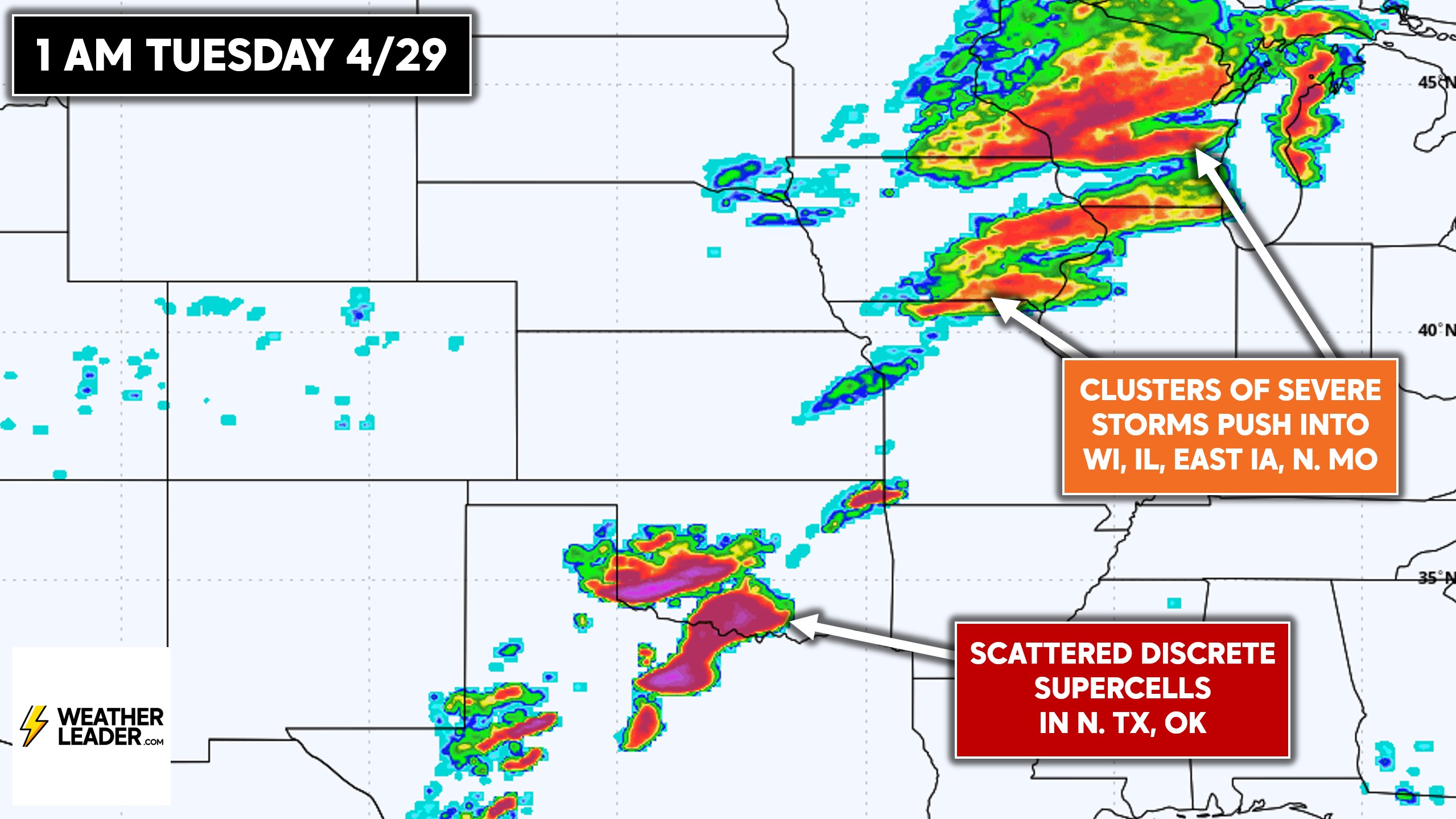
In the Upper Midwest, we will shift to a linear mode late Monday evening into early Tuesday morning. This favors a damaging wind threat, but a few embedded strong tornadoes will still be possible across Wisconsin and Eastern Iowa.
The European model and now shorter range models are showing scattered discrete supercells from OKC to North Texas. Kansas is a bigger question mark due to capping. But those discrete cells may be violent with very strong winds, large hail, and a few tornadoes.
Don’t forget to let friends and family know of this risk! Share it with them below ⬇️
Tuesday’s Severe Threat Shifts East
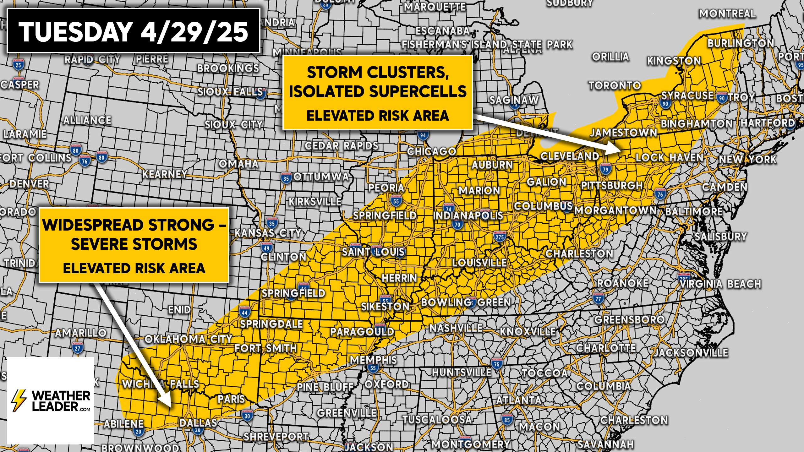
The highest threat Tuesday, while lower than Monday, will be in the Eastern Great Lakes where wind shear is higher. Isolated rotating supercells are possible from Indiana to Western New York and areas in between.
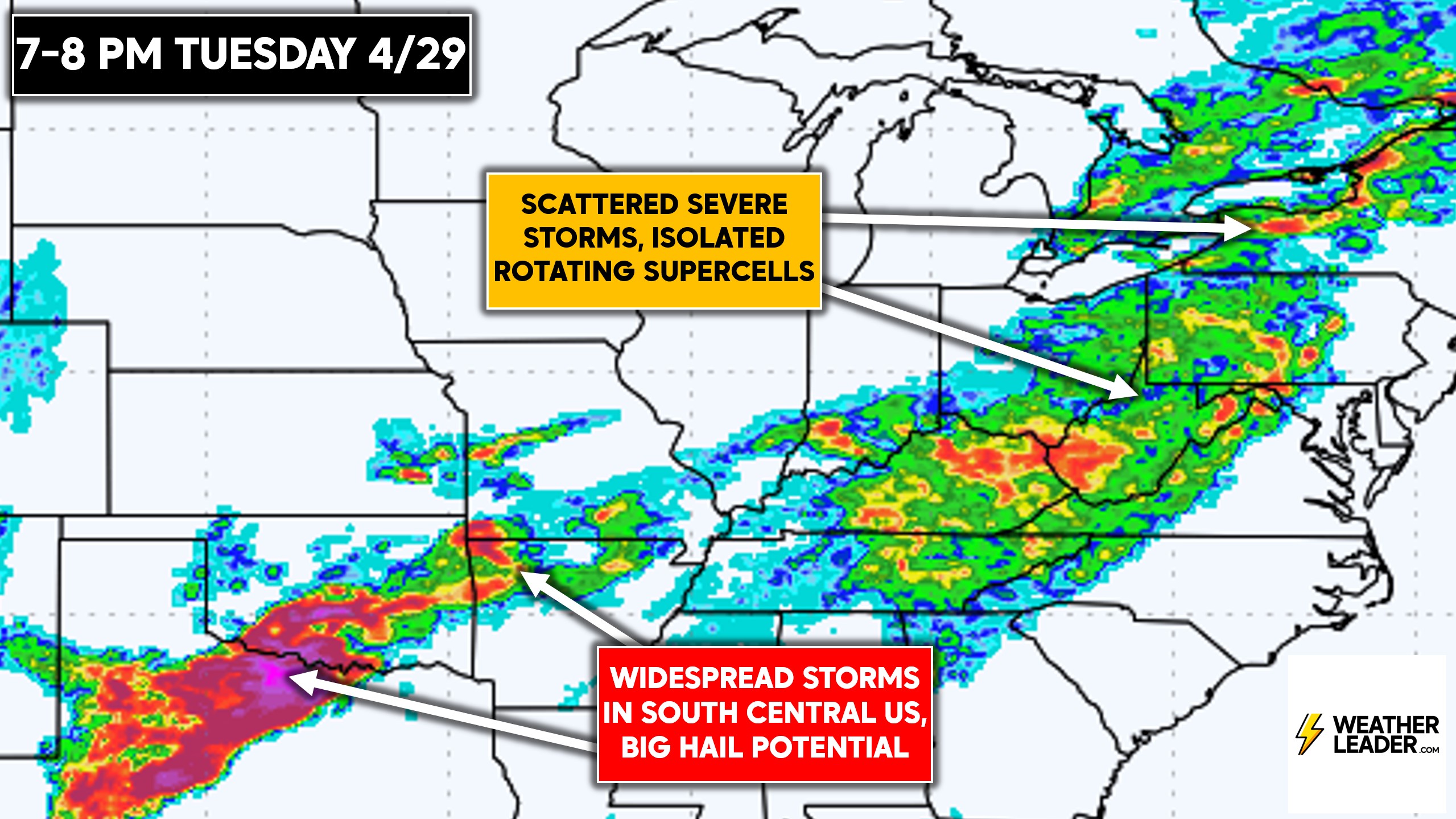
As you go south, especially in the Southern Plains, the threat will be more about widespread severe storms that will pose a large hail risk. In between across the Central Mississippi Valley, all modes of severe weather are possible.
The European model is showing plenty of storms in the Southern Plains, and scattered thunderstorms in the Eastern Great Lakes and Central Appalachians. We will have more details for Tuesday in future updates.
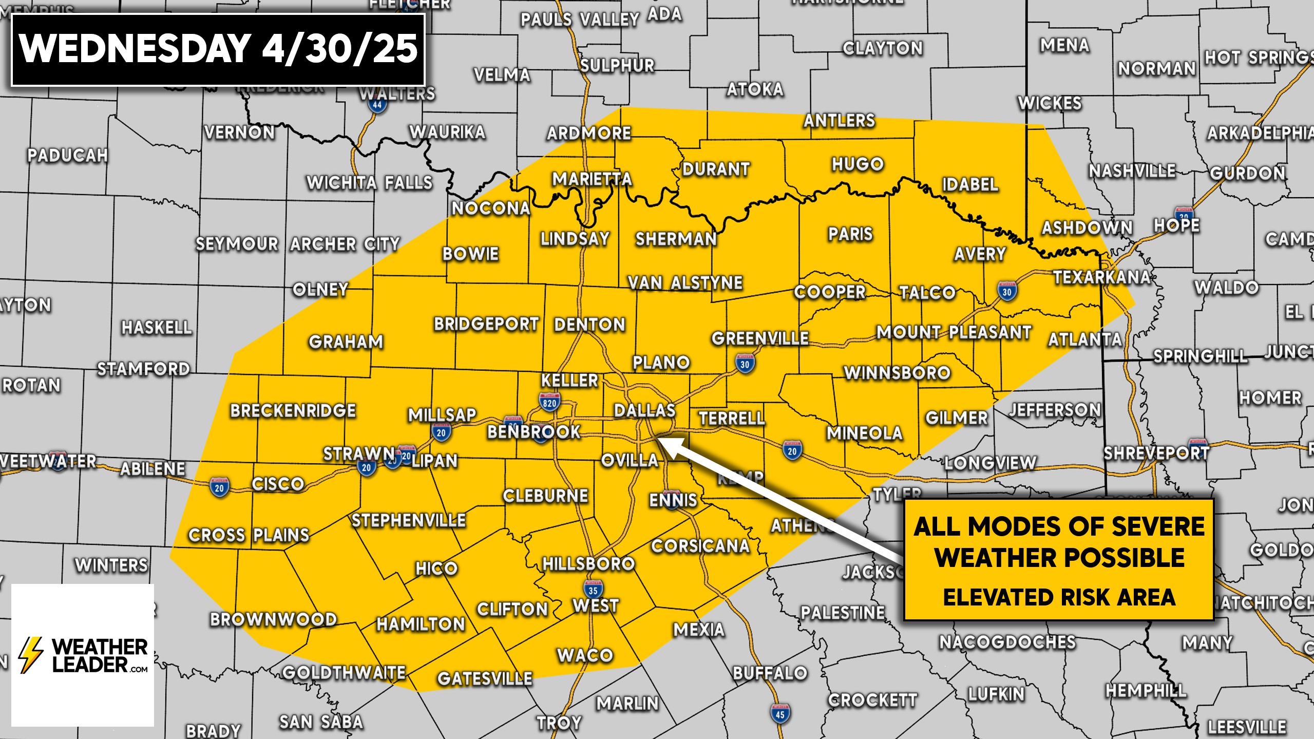
Wednesday’s Texas Severe Storm Threat
The Storm Prediction Center has outlined a smaller area for Wednesday, including North Texas to the Red River in Southern Oklahoma. All modes of severe weather are possible, with damaging winds and large hail as the primary concerns.
We will have the next update on Sunday afternoon! Stay tuned and follow us on Facebook below!