After an active few days of severe weather across West Texas, including DVD-sized hail, the weekend will bring a brief reprieve from any considerable risk.
But the beginning of next week looks more and more concerning, with a growing threat of a tornado outbreak in the Upper Midwest. Supercells are also possible in the Plains, across Oklahoma and Kansas.
Monday’s Severe Weather Outbreak
A strong low pressure system way up near the Canadian border will usher in a strong low level jet to the south, transporting warm and most Gulf air all the way to the Twin Cities. The closer you are to a low pressure, generally the more wind shear.
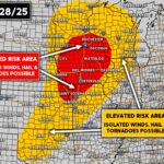
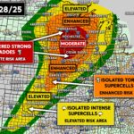
This is why the highest threat for tornadoes in from Minneapolis to Des Moines to Kansas City. But the Enhanced Risk extends all the way from near Wichita to just west of Green Bay, as shown below.
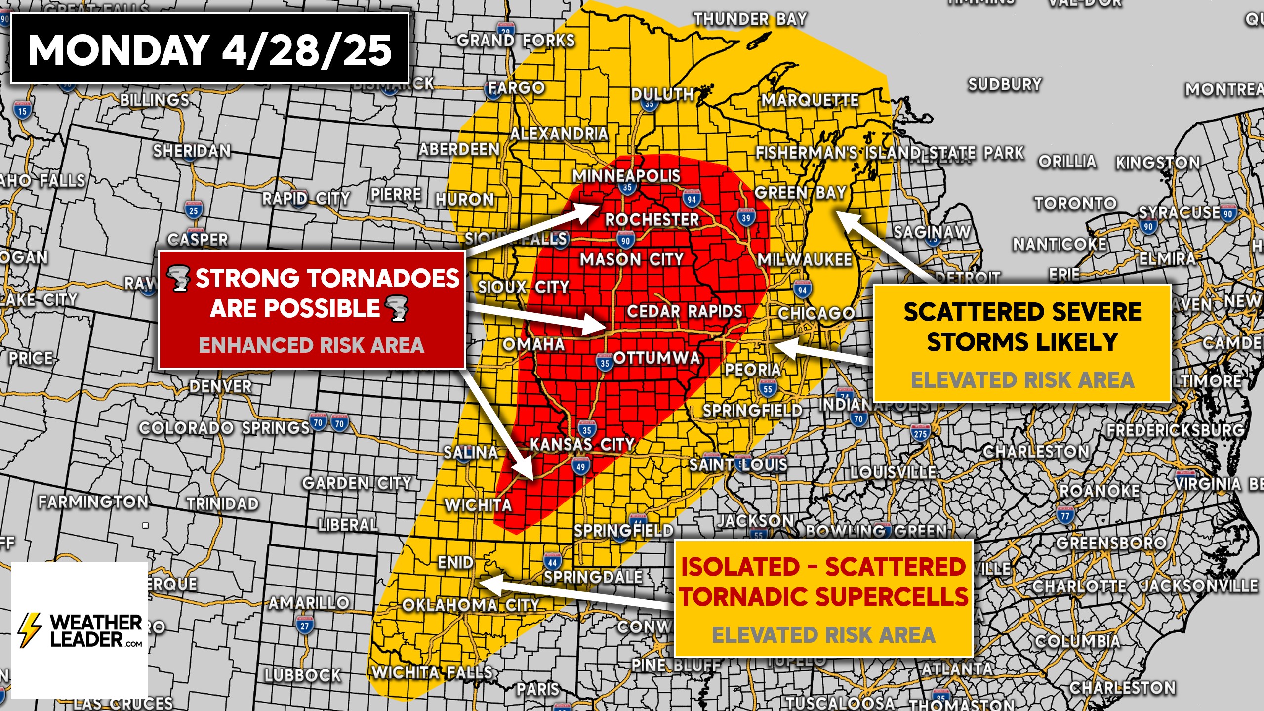
I would not be surprised to see a Moderate Risk issued in the Day 3 Outlook, or in future updates. The wording from the Storm Prediction Center’s discussion is used on our graphic above, and it is agressive!
Widespread strong to severe thunderstorms are likely north of Minneapolis. The potential for more violent storms, capable of producing strong tornadoes south of the Twin Cities heading down into Iowa and Northern Missouri.
In Eastern Kansas, down thrown Oklahoma the the Red River Valley, we expect isolated to scattered discrete supercells. Some of these may produce strong tornadoes as well.
However, the development of storms in the Southern Plains is more dependent on the cap breaking and storms firing off a dryline near Wichita and OKC.
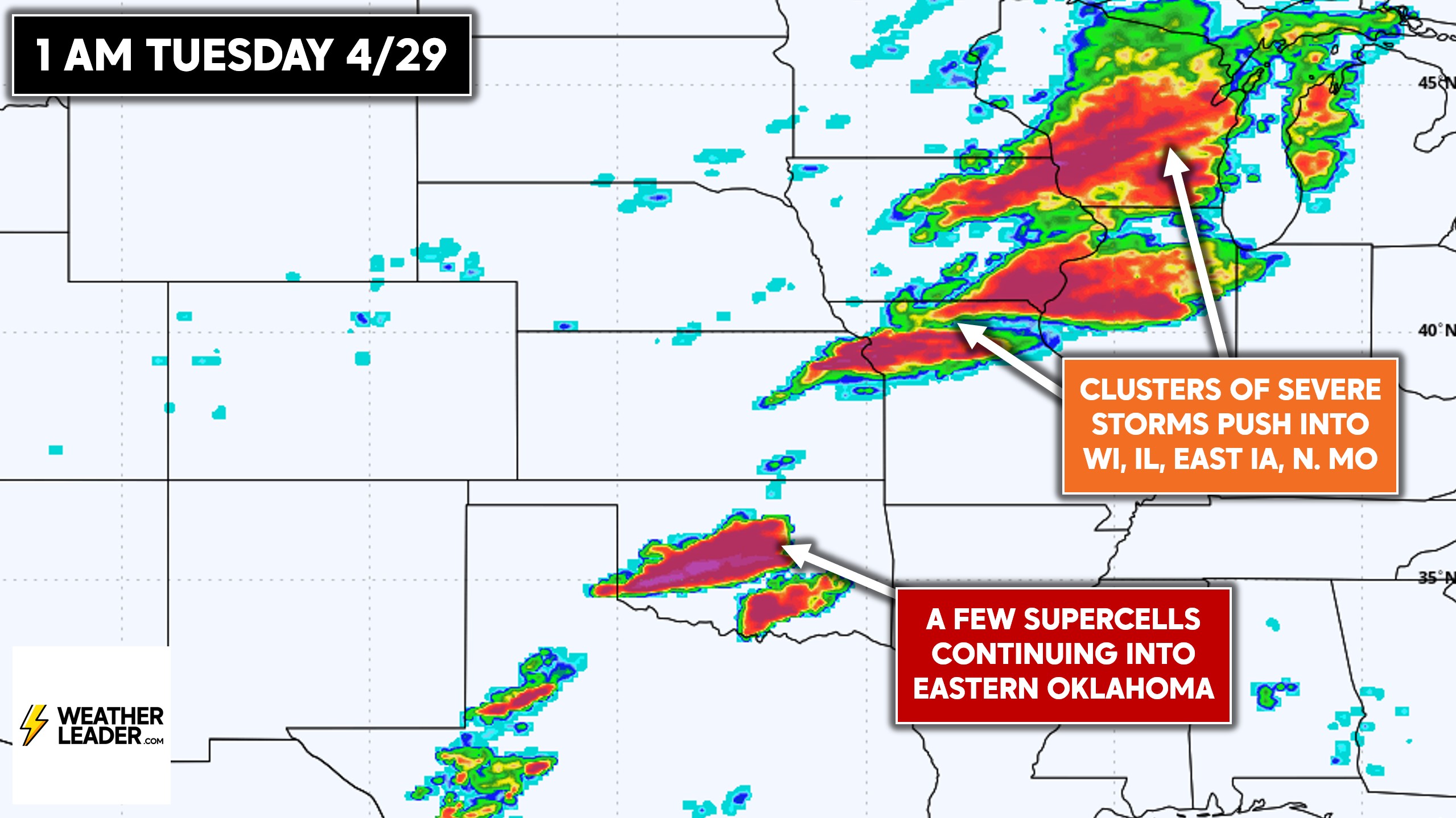
As we go into the night, we expect the tornado threat to decrease somewhat as the storms head through Wisconsin and Illinois. Nonetheless, a tornado threat still exists away from the lake in places like Madison, WI and Davenport, IA.
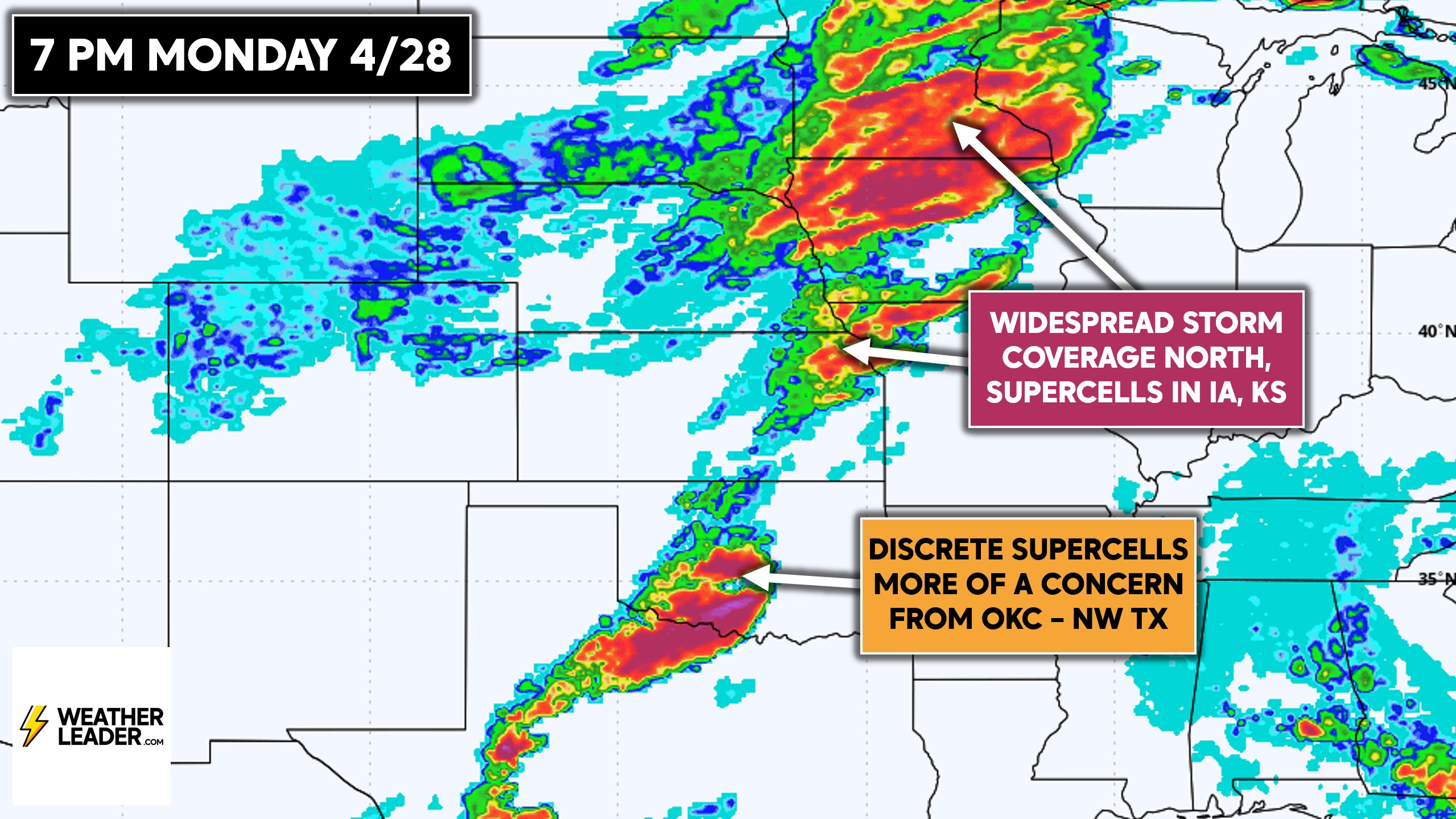
Severe weather will likely make its way through the OKC Metro Monday evening, reaching Eastern Oklahoma by early Tuesday morning.
Tuesday’s Severe Weather Outlook
With the low pressure hundreds of miles into Ontario and Quebec by Tuesday, highest wind shear will now be over the Great Lakes. So while we believe Tuesday will be mainly a damaging wind threat, the potential for a few tornadic supercells still exists in the Great Lakes.
Now with that said, Tuesday’s tornadoes will likely be much weaker and short-lived versus Monday’s tornadoes. Hail is a low to moderate concern as well, especially in the South Central US.
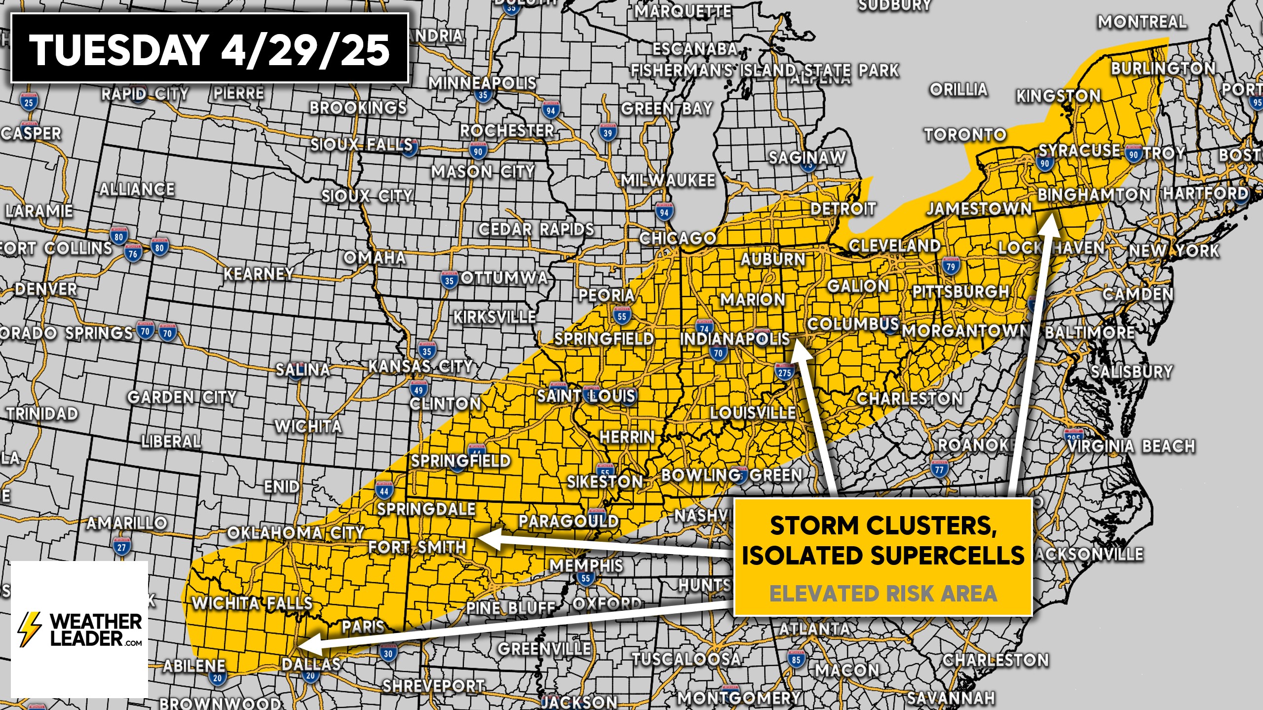
The latest European model shows more in the way of storm coverage across the South versus the Ohio Valley and Northeast. However, hodographs are suggesting a higher tornado potential across Indiana, Ohio, and Western PA.
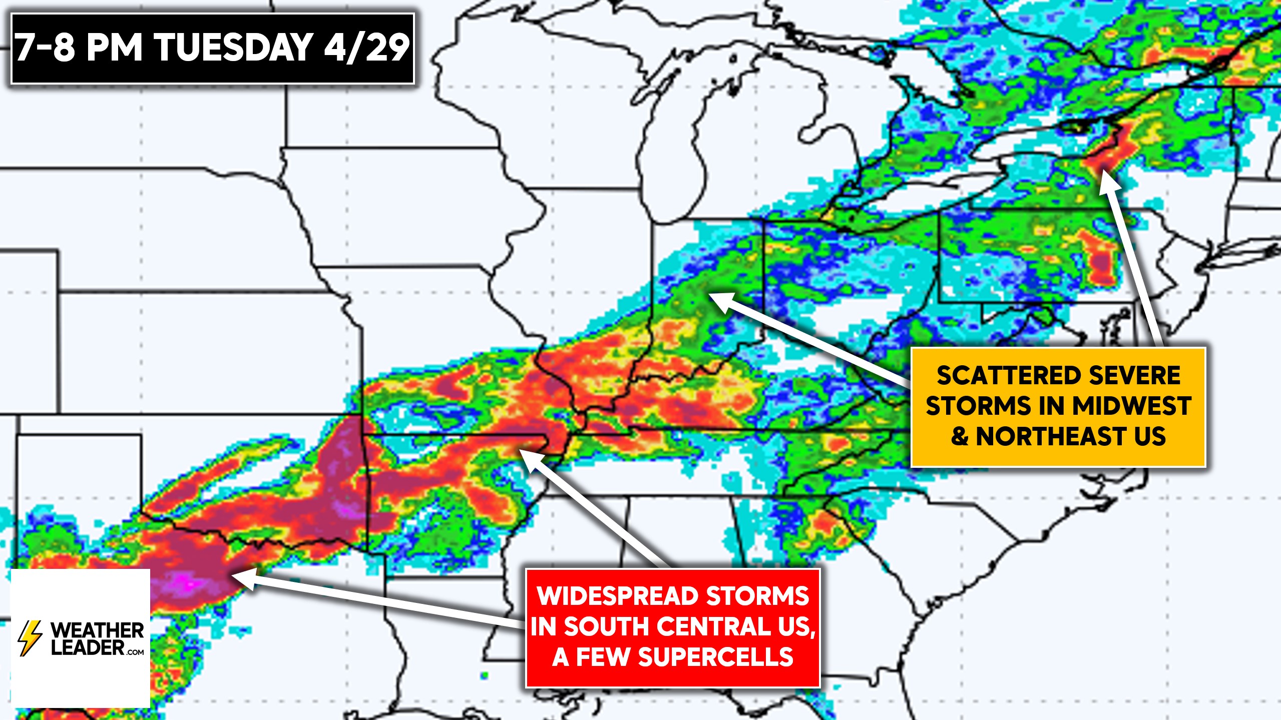
So as mentioned, the storms down south are more likely to be hailers than tornado producers. Here’s a look at the European model’s thunderstorm coverage for Tuesday evening!
By middle to late next workweek, there may be a severe thunderstorm threat across the Southeast/Gulf Coast. It doesn’t look particularly significant, but we will keep you undated.
Be sure to share this forecast with friends and family using the blue button. Stay safe!