After a tornado near Essex, Iowa broke the Iowa state record for the widest tornado to ever hit in the state at a whopping 1.78 miles wide, more severe weather is likely soon.
A strong low pressure in the Northern Plains combined with strong wind shear and ample instability will create favorable conditions for the development of supercells in parts of the Upper Midwest Monday evening.
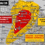
Monday’s Severe Weather Risk
This includes a large area from the southern suburbs of Minneapolis to near Kansas City, which encompasses nearly all of Iowa and as far west as the Omaha Area. See NOAA’s Storm Prediction Center Forecast for Monday 4/28 below.
An Enhanced Risk area is up for the aforementioned area, with an elevated risk surrounding it and including a much larger swath of the Plains and Upper Midwest. The Storm Prediction Center mentions the potential for a risk increase in Kansas and Oklahoma, pending further guidance.
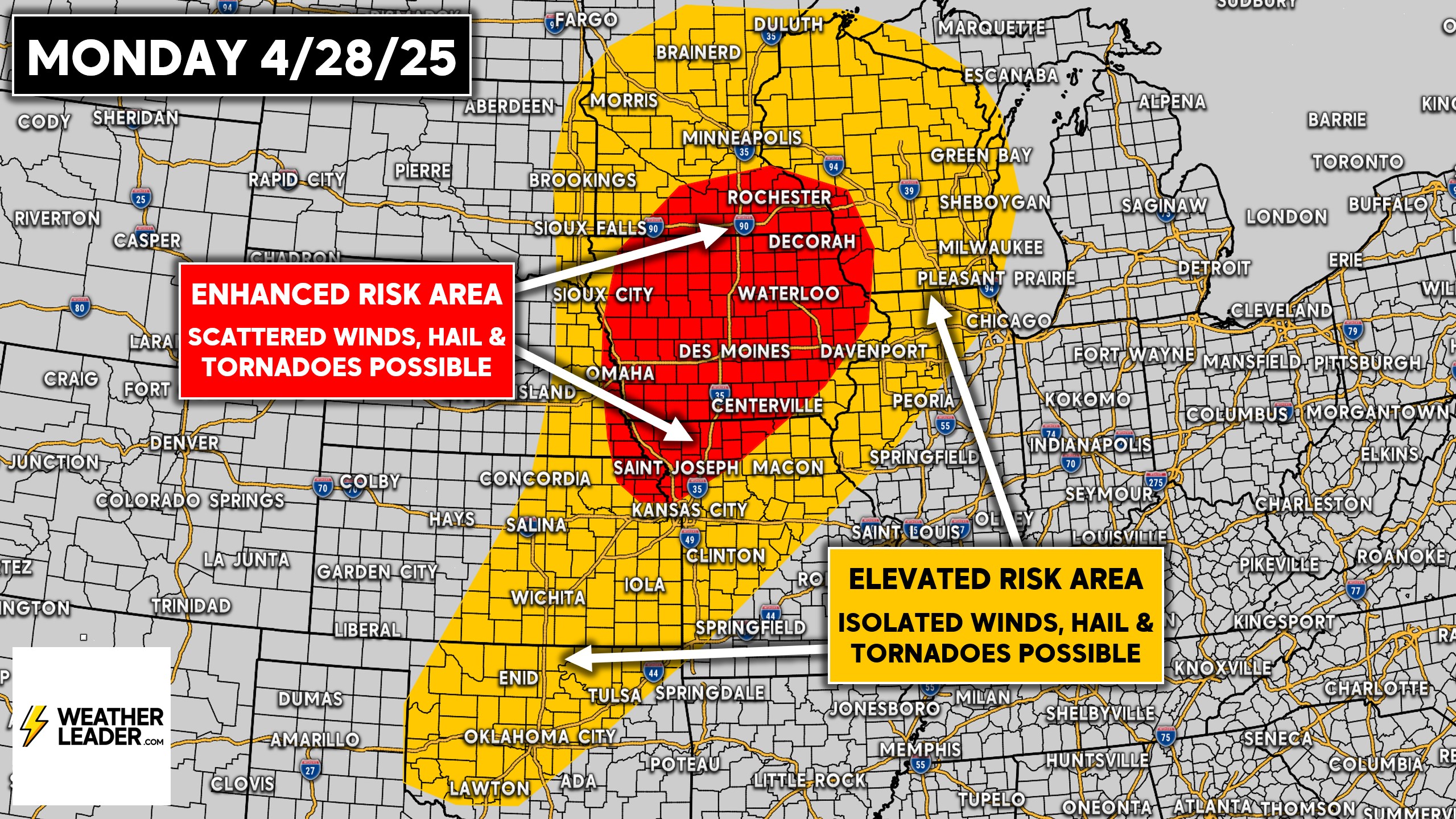
The big wildcard for places like Wichita and OKC will be how strong the capping is. Capping is a small area of warm, stable air a few thousand feet up that prevents the rising, unstable air from reaching the higher altitudes and initializing thunderstorm development.
Now in this sort of environment, there is the danger for a few discrete supercells to produce tornadoes because of them essentially having more room to breath and not being surrounded by other storms. You can see this below on the European model for 7 PM Monday.
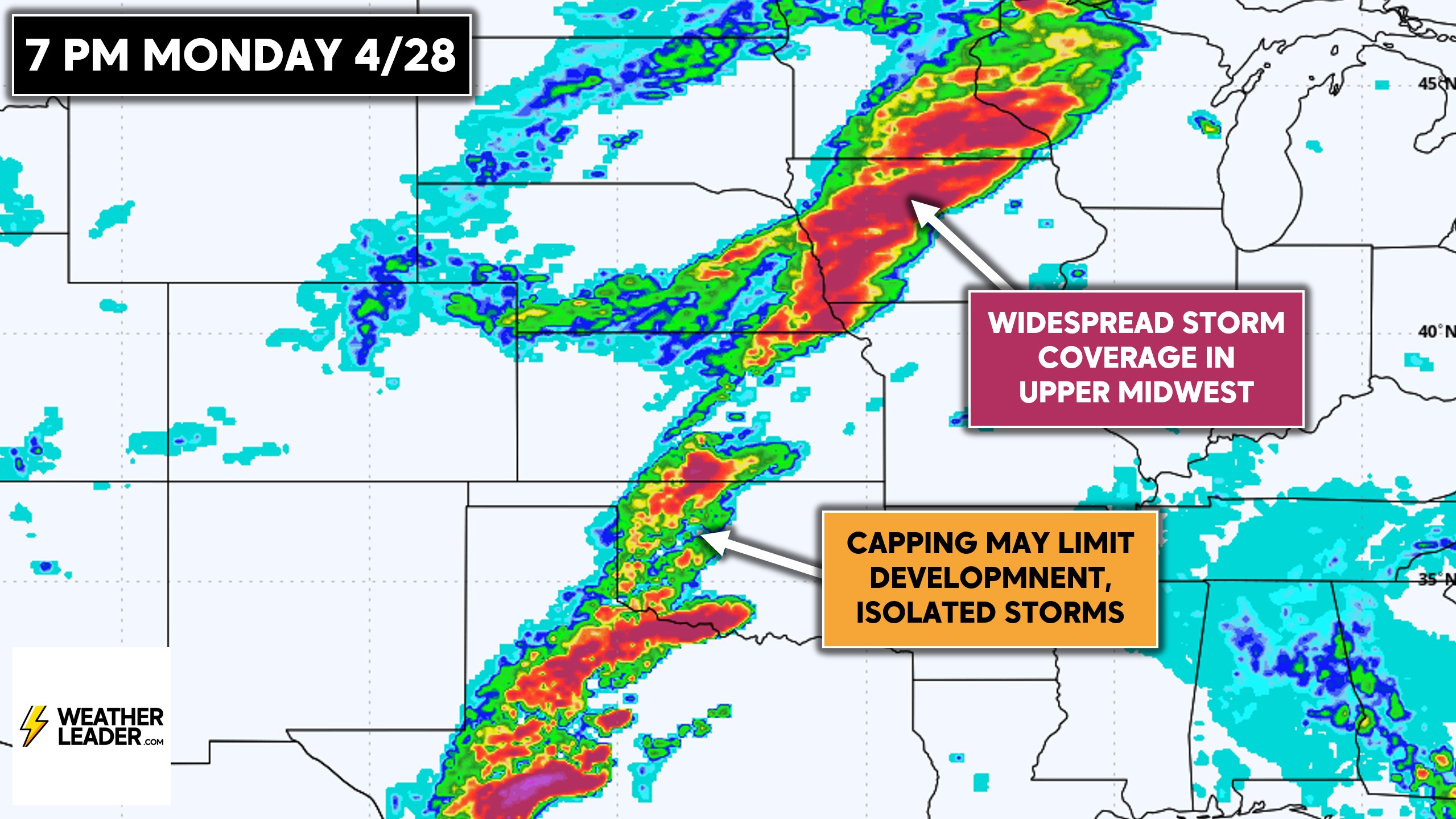
Models are indicating the potential for widespread severe thunderstorms in the Upper Midwest, across the current enhanced risk area. And below you will see what we mean by the potential for a few discrete supercells in the Southern Plains. Really from Wichita Falls, TX to Eastern Kansas.
Tuesday’s Severe Weather Risk
The severe thunderstorm threat will head east on Tuesday into the Ohio Valley and Ozarks, down into North Texas. At this point, with the low pressure being well into Canada, Tuesday’s threat looks to be tied to the cold front pushing through.
Meaning we believe Tuesday will be mainly a damaging wind threat kind of day. There may still be a few tornadoes, but certainly a lower tornado threat than on Monday.
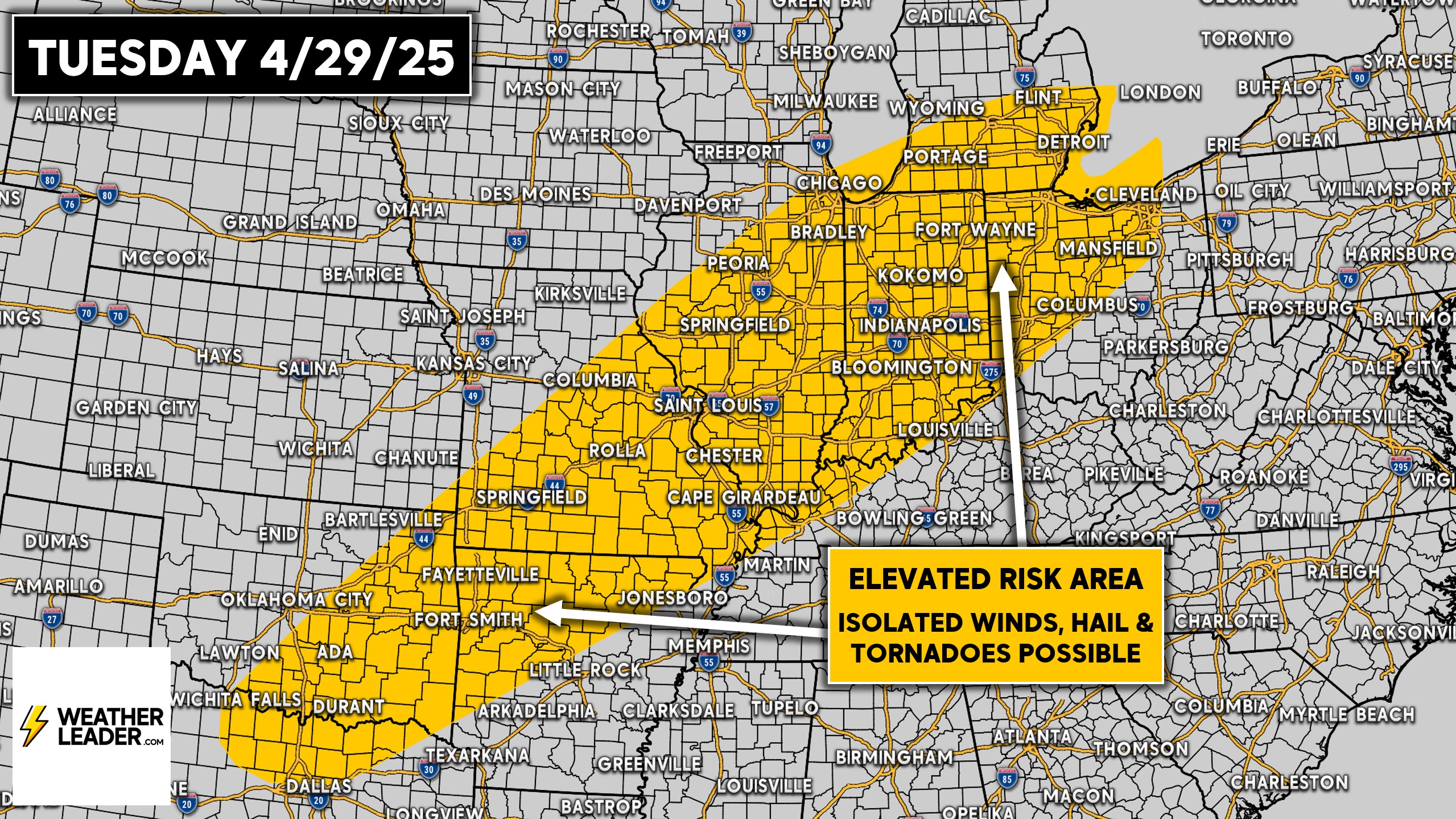
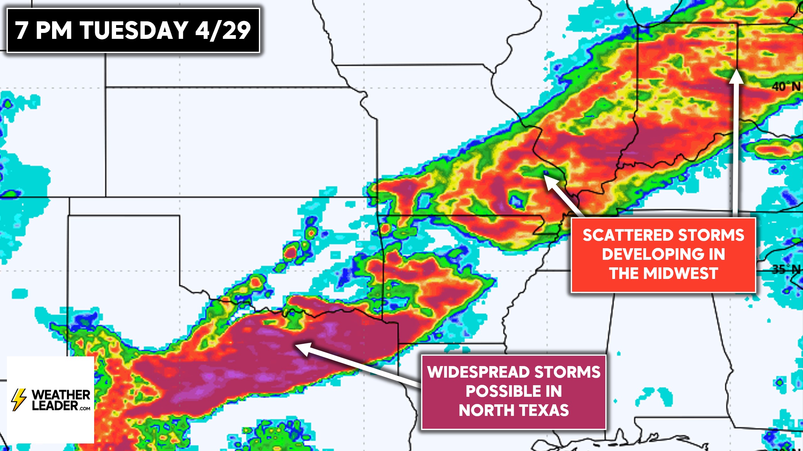
The European model is signaling the development of a broken line of storms ahead of the cold front in the Midwest across NW Ohio, much of Indiana, Southern Illinois and Missouri, and Northern Arkansas.
More widespread strong to severe thunderstorms are possible across North Texas, with best dynamics closest to the Red River. But this may still include the Dallas-Fort Worth Metroplex.
That’s it for today’s update! Don’t forget to share this forecast with friends and family in affected areas!