With a tornado outbreak possible Monday in the Upper Midwest and an Enhanced Risk on Tuesday in the Eastern Great Lakes, we have a lot of info to cover! This article will be loaded with useful information.
When it comes to timing graphics, please remember it’s just one model, albeit typically the most accurate. You should keep track of radar and alerts during the entire time your area is under a severe threat!
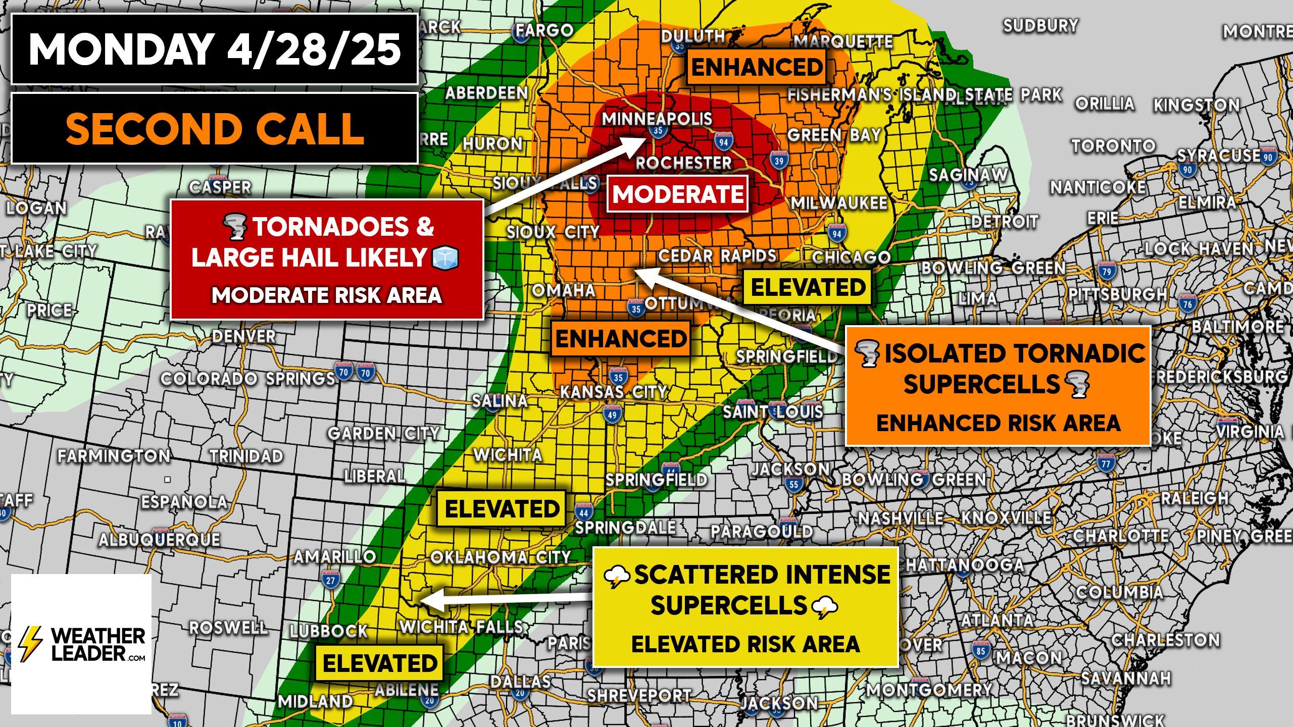
Monday’s Tornado Outbreak Potential
The Storm Prediction Center has trimmed the southern extent of the Moderate Risk area to no longer include Des Moines, while expanding it slightly north in Minnesota and Wisconsin.
The Enhanced Risk was also now include Green Bay and west Milwaukee suburbs, while being removed from much of Eastern Kansas, south of Kansas City.
There is much less uncertainty in the Moderate Risk area as to the development of severe thunderstorms, some of which being tornadic. But as you head south into Iowa and down through the Plains, the risk is likely contingent on capping.
Due to lower wind shear in the Southern Plains, the risk is mainly related to large hail and damaging winds, with a few isolated tornadoes possible.
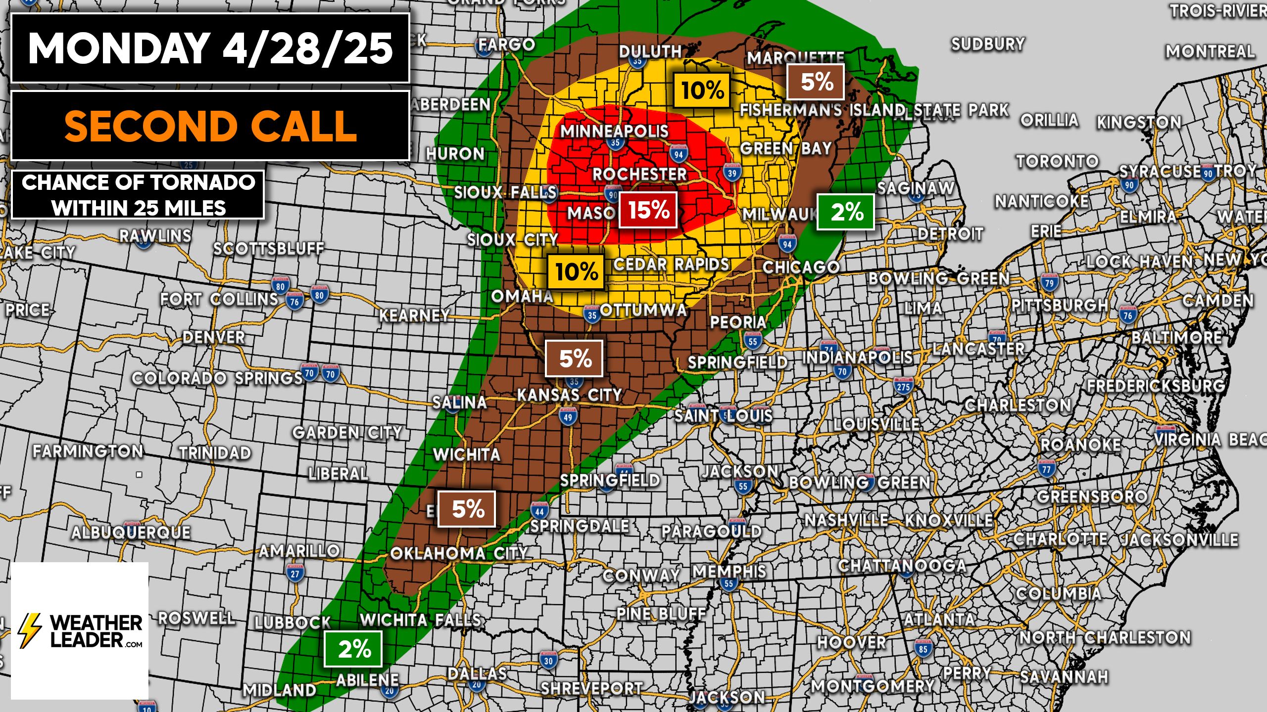
Speaking of tornadoes, the higher probabilities are across the Upper Midwest. And while a 10-15% chance of a tornado hitting within 25 miles, it’s actually considerably high.
We can go back in a few days and show a map of tornado warnings issued, and it would likely be dramatic across that 15% area. If we could post that map right now, it would be much more concerning for those who see they’ll be under a tornado warning at some point. All that to say, take this seriously.
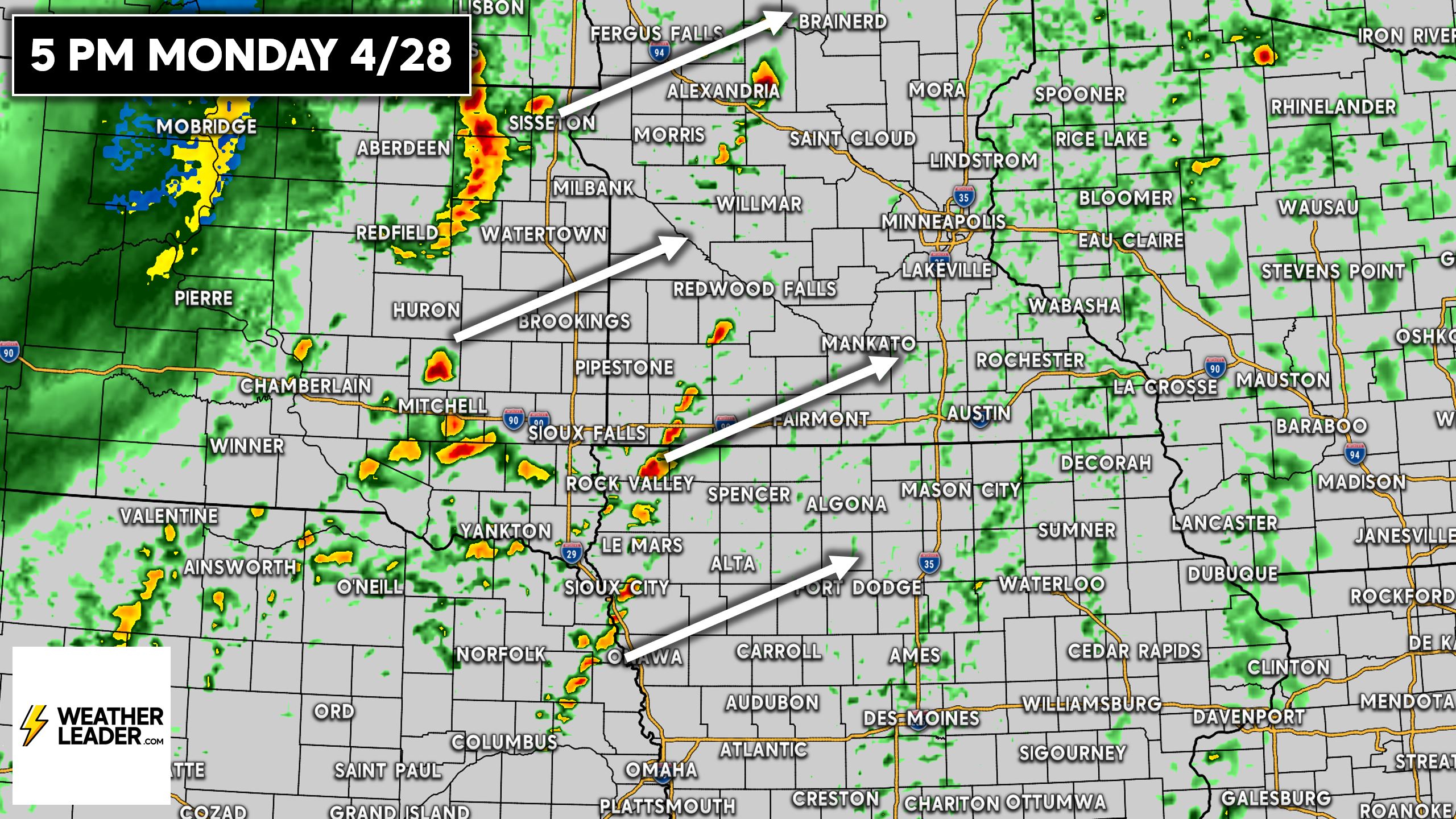
We expect thunderstorms to develop in Eastern SD and NE around 4-5 PM Monday. There may also be some activity in Western MN and IA at this time. These storms will strengthen as they push northeast.
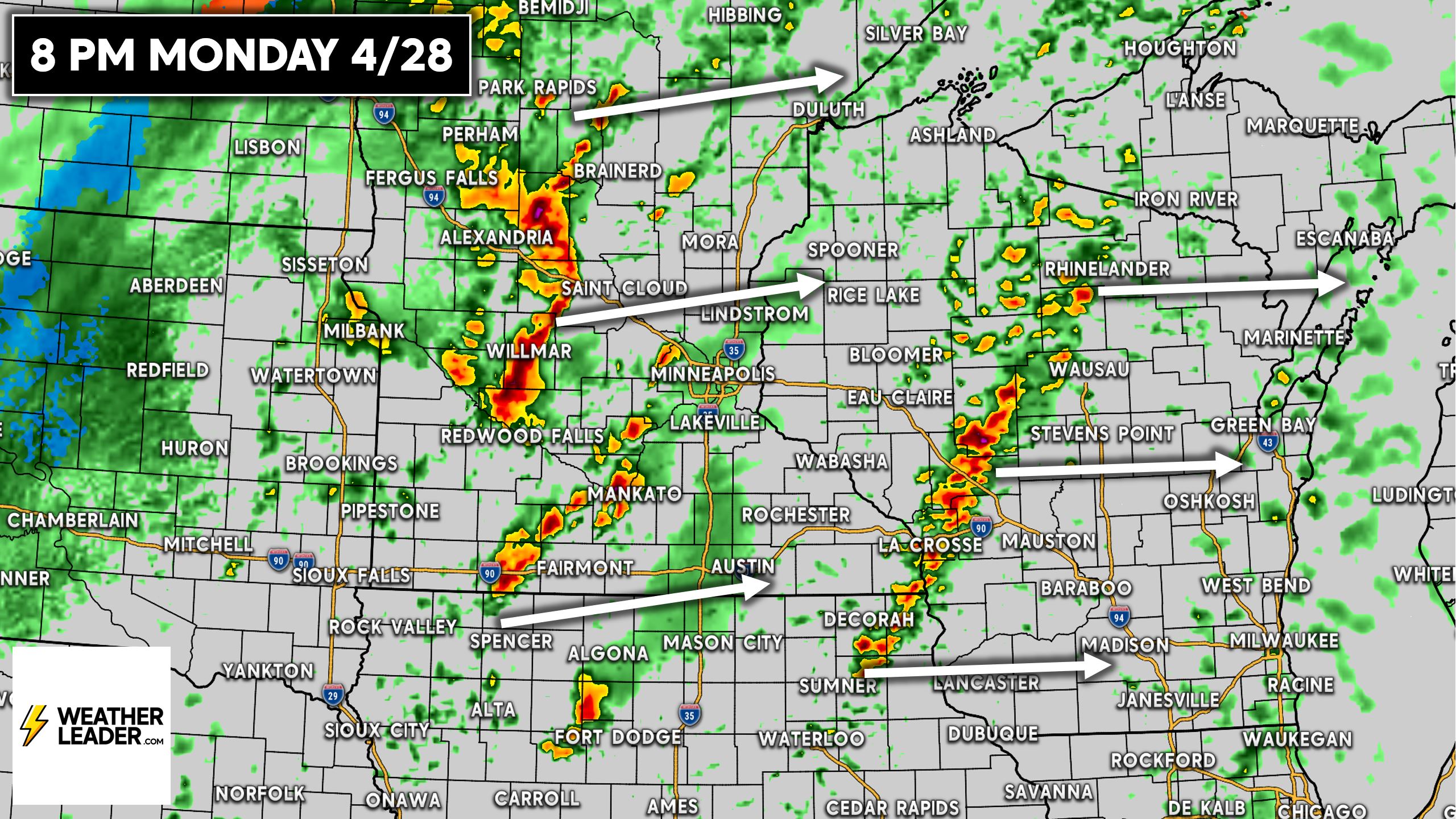
By shortly after dinnertime Monday, we fully expect the extent of severe weather to become significant. Clusters of supercells thunderstorms are likely across much of Minnesota and Northern Iowa, with tornadoes expected on strong cells.
You also see activity in Wisconsin at around 8 PM Monday, which will pose a slightly lower, but still considerable risk with all severe modes possible. Severe modes refers to damaging winds, hail, and tornadoes.
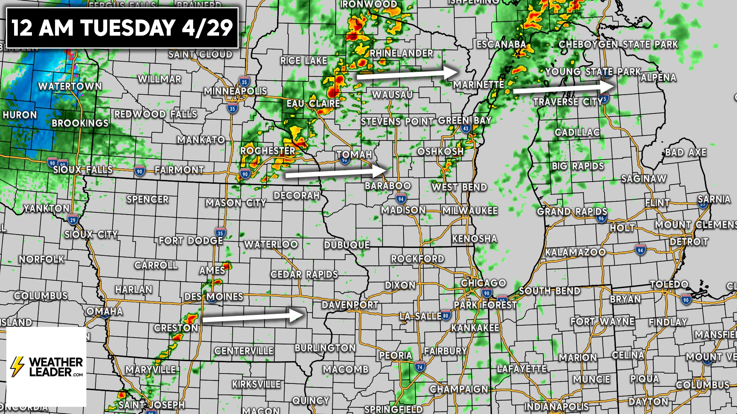
The Minneapolis-St. Paul Metro looks to see the worst of the storms between 7 – 11 PM Monday evening. By midnight, clusters or potentially a broken line of severe thunderstorms will be pushing through Wisconsin. There may also be some activity closer to the lake.
Below is the Hi-Res NAM Future Radar for 12 AM Tuesday. Storms will continue to weaken as they push east into the early morning hours of Tuesday.
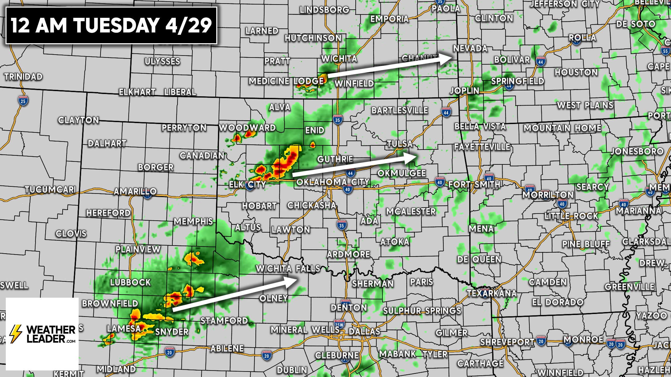
We may not see much activity fire in the Southern Plains until late Monday evening, or at least that’s what guidance suggests. Really by 9-10 PM is when we may see first storms fire off the dry line in Western Oklahoma and West Texas. These storms will push east-northeast into the OKC and Wichita Falls areas.
6K Followers
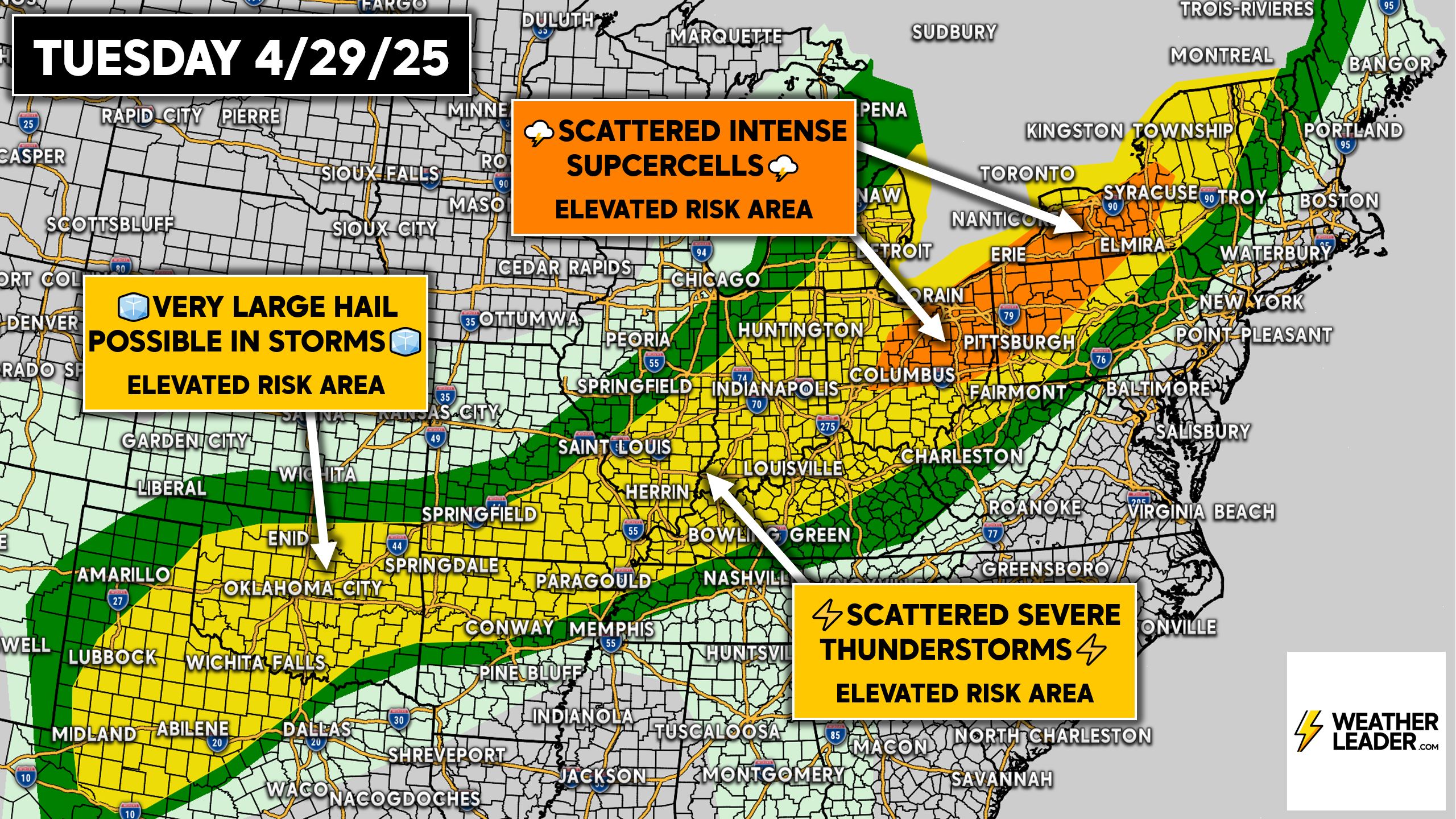
Tuesday’s Enhanced Severe Thunderstorm Threat
The action will shift southeast on Tuesday, with the SPC issuing an Enhanced Risk in parts of the Eastern Great Lakes including from Columbus to Syracuse.
Scattered, intense supercells are possible in that area before a line of severe thunderstorms with embedded large hail and isolated tornadoes develops.
Very large hail and a few tornadoes is also possible in Oklahoma and parts of North Texas.
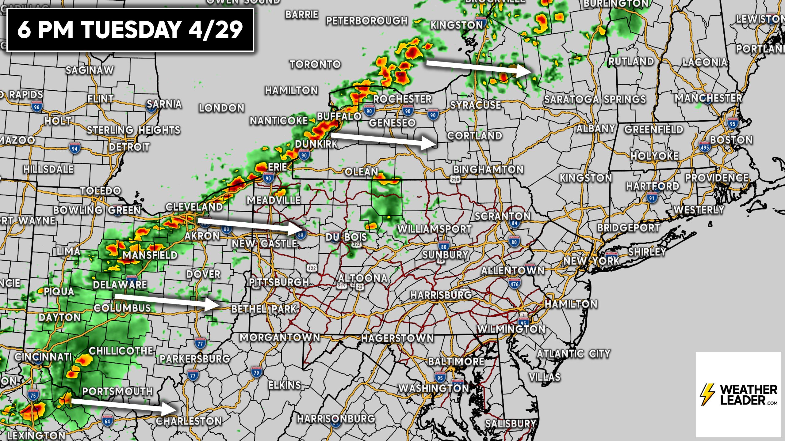
By dinnertime Tuesday, this line of storms with embedded supercells is likely to be along the Lake Erie’s eastern shores and up into Lake Ontario. This line will bring nasty weather through the entire I-90 corridor from Cleveland to Syracuse.
Storms will then continue east Tuesday evening in Eastern OH, Western PA and NY before weakening across the Appalachians late Tuesday evening.
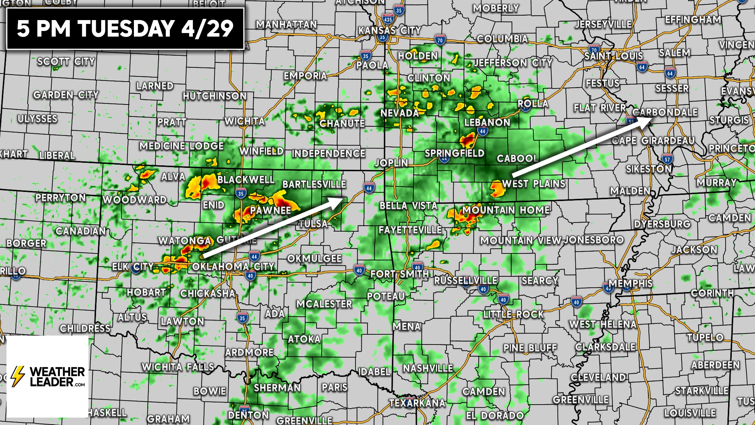
Back in parts of the Southern Plains and the Ozarks, scattered severe thunderstorms capable of producing very large hail will develop during the Tuesday PM commute and push northeast.
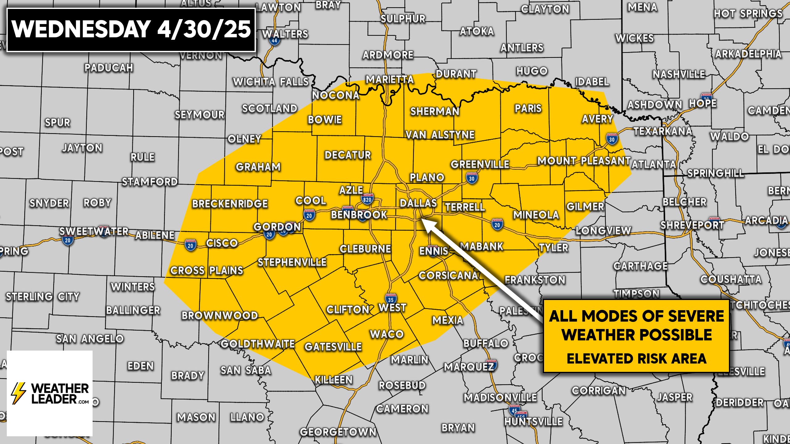
Oh, but there’s more! A much smaller area encompassing North Texas will be under the risk of severe weather on Wednesday. It doesn’t look too significant, but still a concern for all modes of severe weather.
If you found any of this information useful, be sure to share it with your friends and family below. Stay safe and weather aware everyone!