After it seemed like the Upper Midwest dodged the worst of the threat on Monday, Tuesday was quite the day in the Eastern Great Lakes across Ohio, PA and NY. We expect a derecho to be confirmed, having started near the OH/IN border and extending into Central PA.
Wednesday’s Severe Weather Outbreak in the Southern Plains
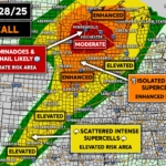
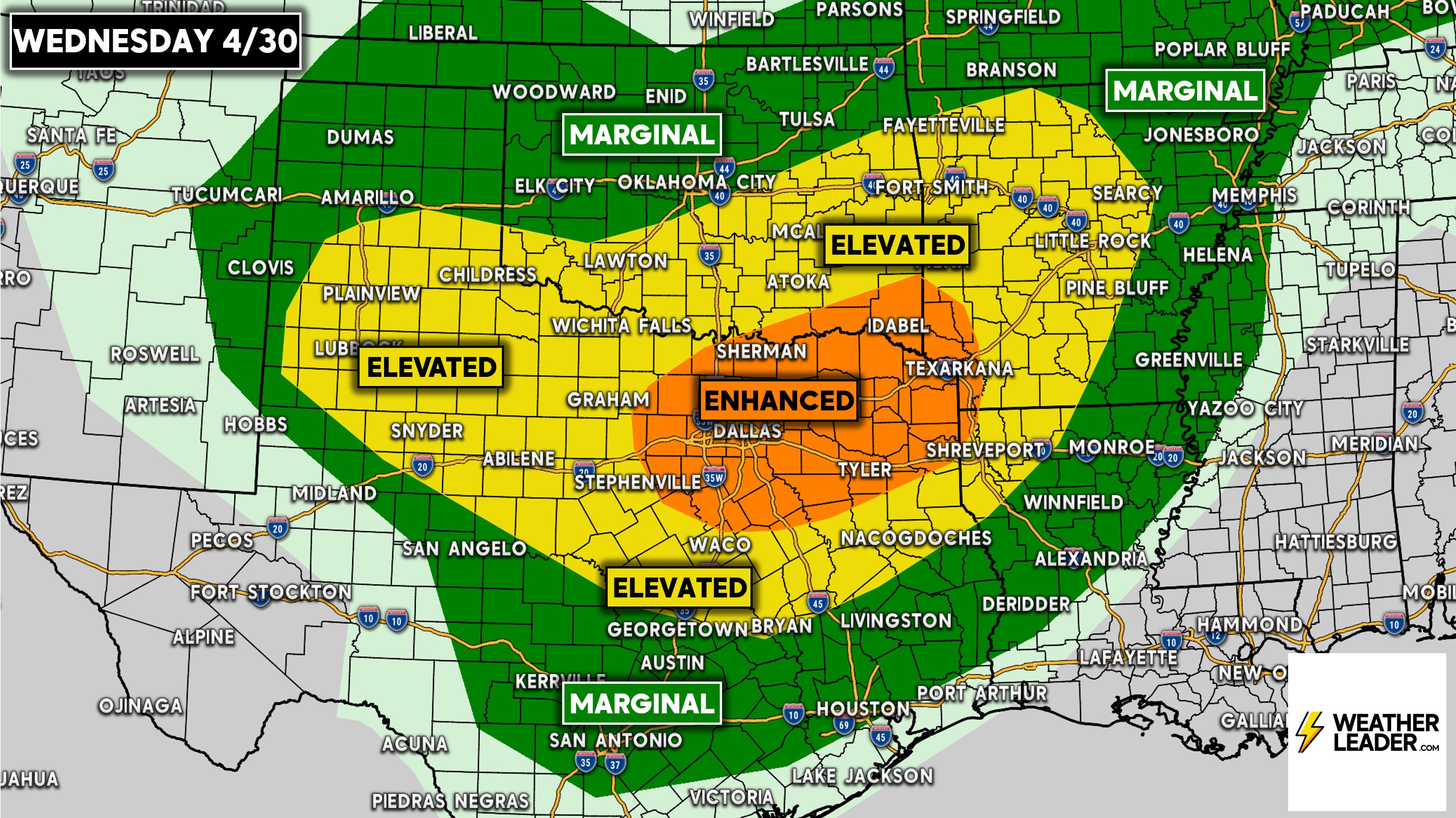
Our attention now turns to a heightened tornado risk across North Texas today, with the SPC placing the area under an Enhanced Risk with a 10% tornado probability. This is relatively high. Here is the SPC’s categorical outlook.
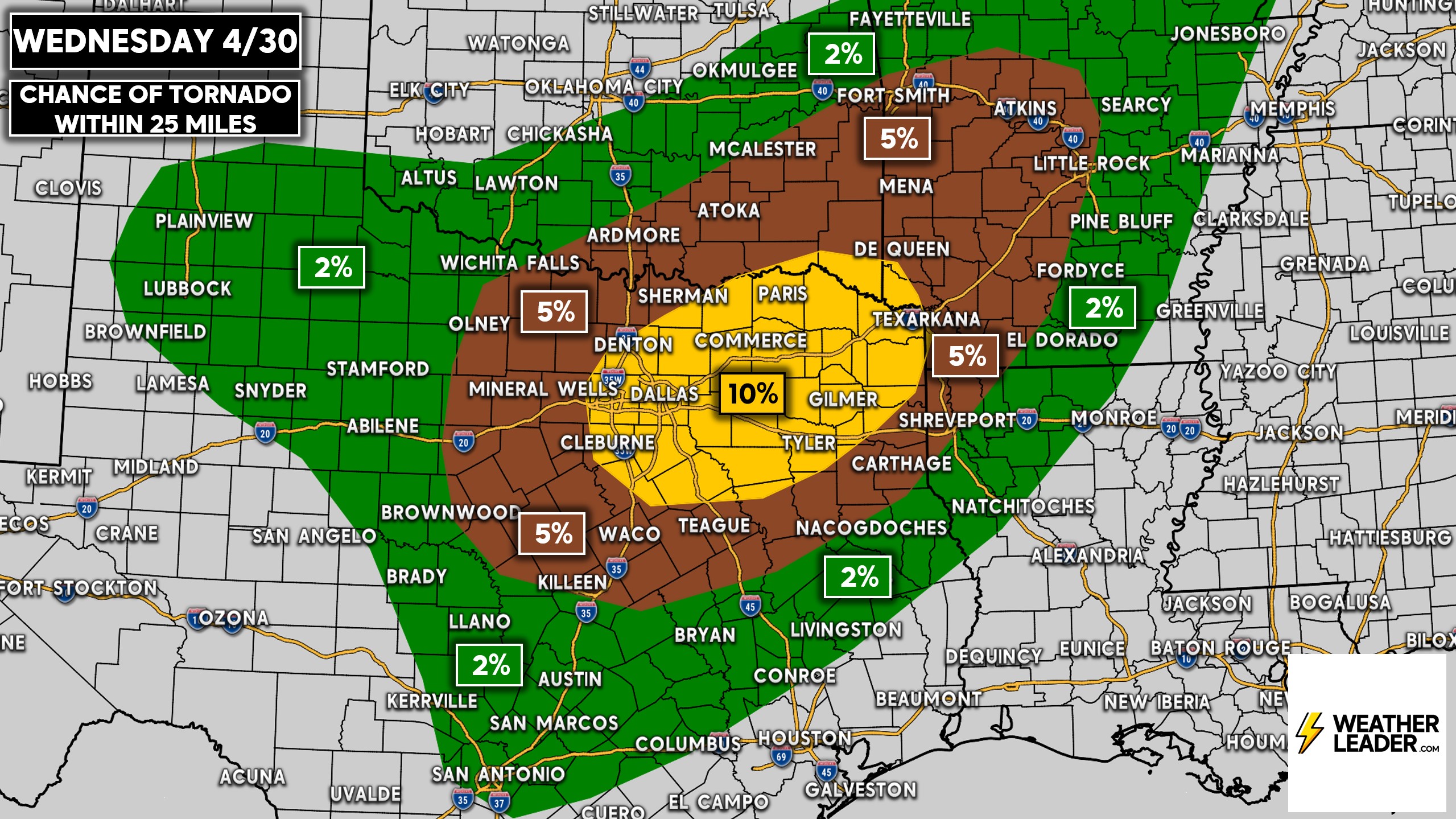
And here you will see that 10% tornado probability risk area.
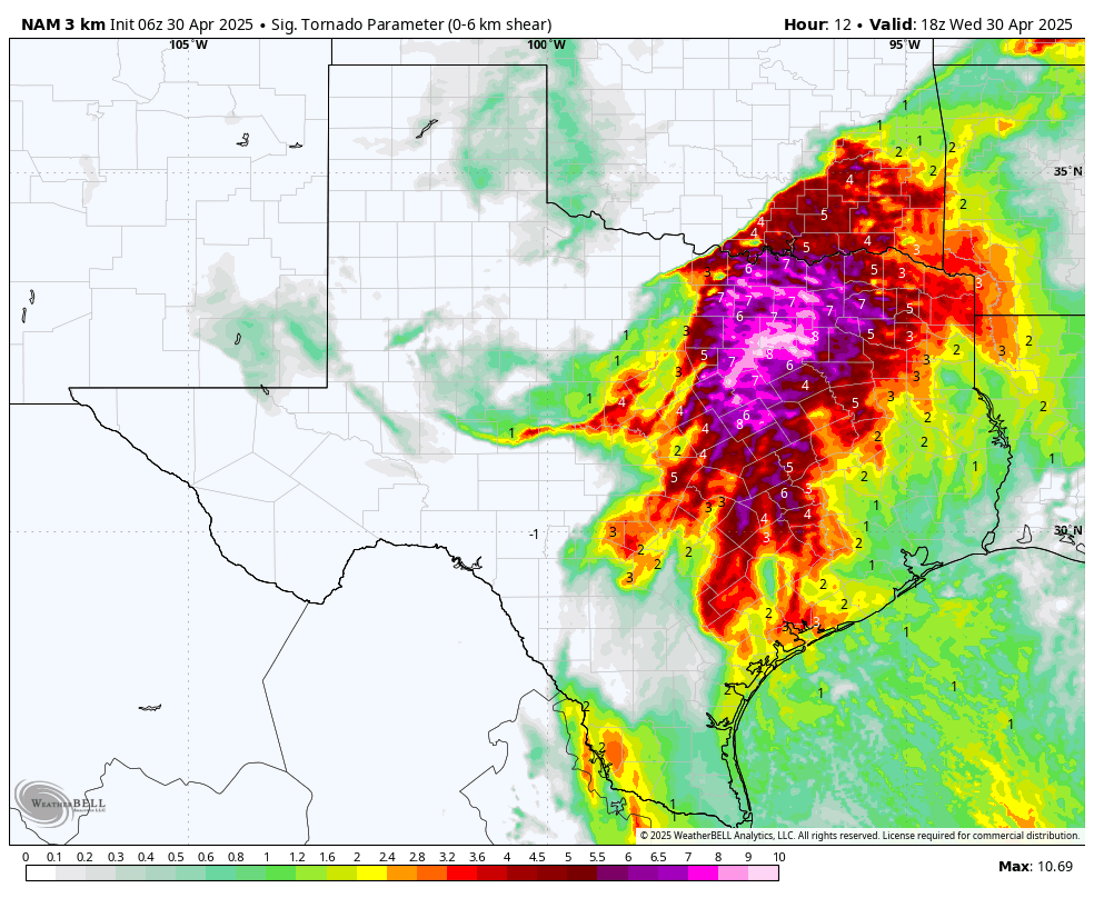
Short-range mesoscale models are particularly enthused about the tornado potential across Southeast Oklahoma, North Texas, and far Western Arkansas. Below is the Hi-Res NAM’s significant tornado parameter for Wednesday afternoon, which is very high across North Texas and SE OK.
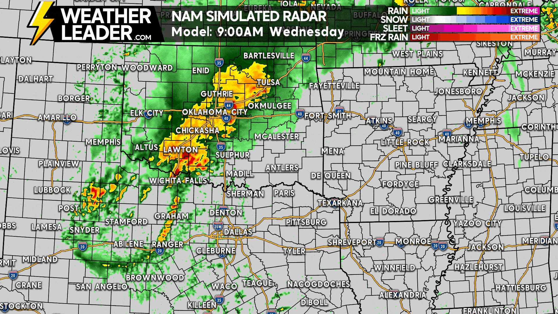
Here is a look at future radar timing on the Hi-Res NAM for Wednesday’s storms across the Southern Plains. The threat in DFW looks to be between 3-10 PM.
Be sure to share this forecast if you have friends and family in the risk area!
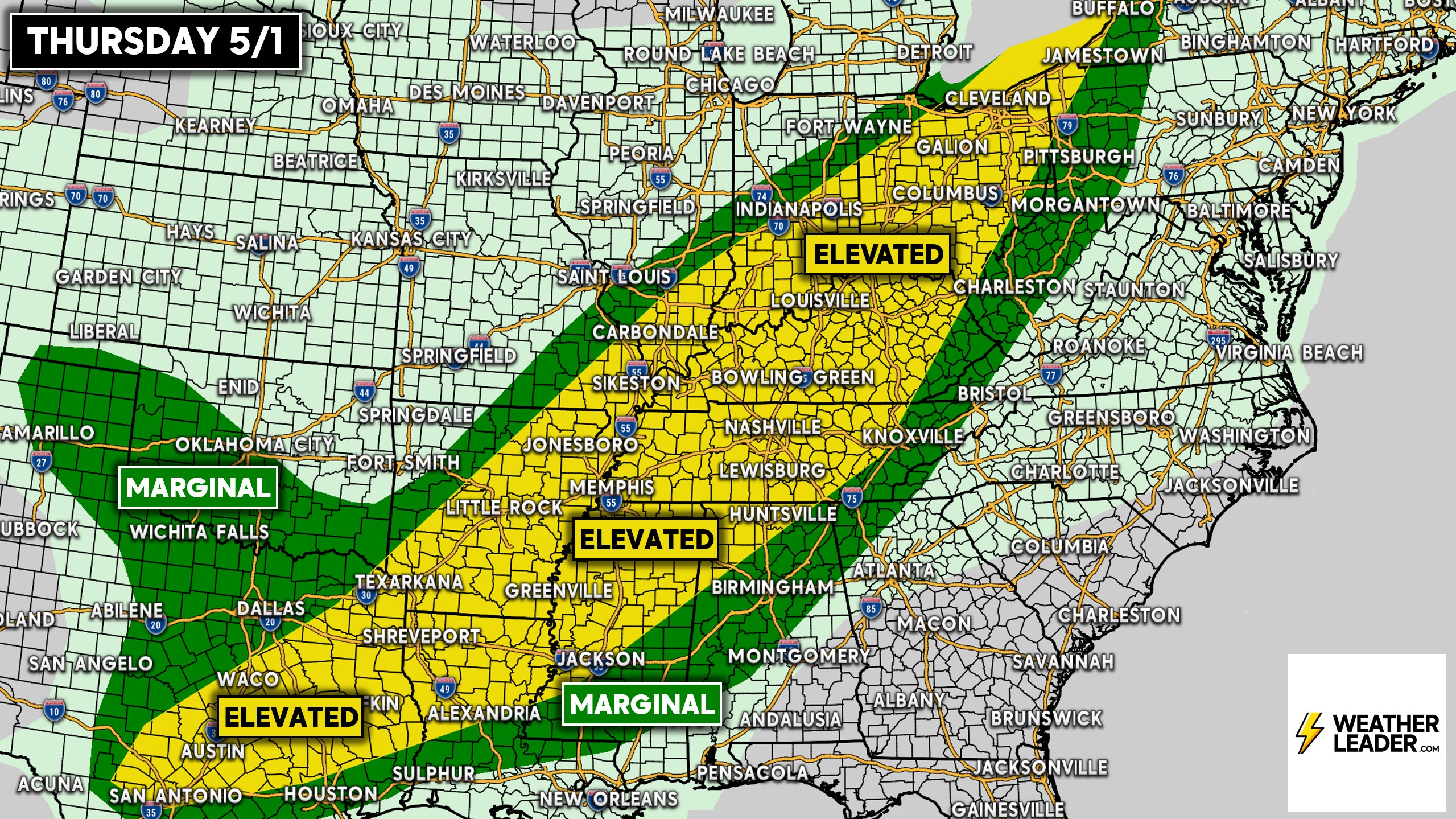
Thursday’s Severe Thunderstorm Potential from Gulf Coast to Ohio Valley
The risk area on Thursday will be much more expansive, ranging from San Antonio to Buffalo! Fortunately, the tornado threat is very low. Besides from a hail threat in Texas, this will be primarily a damaging wind risk.
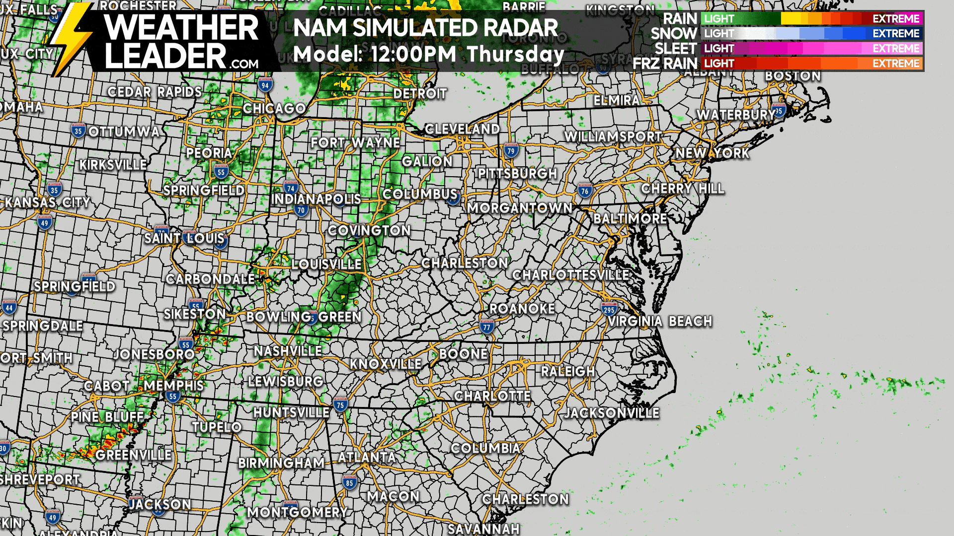
Below is Hi-Res NAM Future Radar for Thursday’s storms.
Thanks for reading, and don’t forget to follow our Facebook page for more updates like these! Just tap below!